
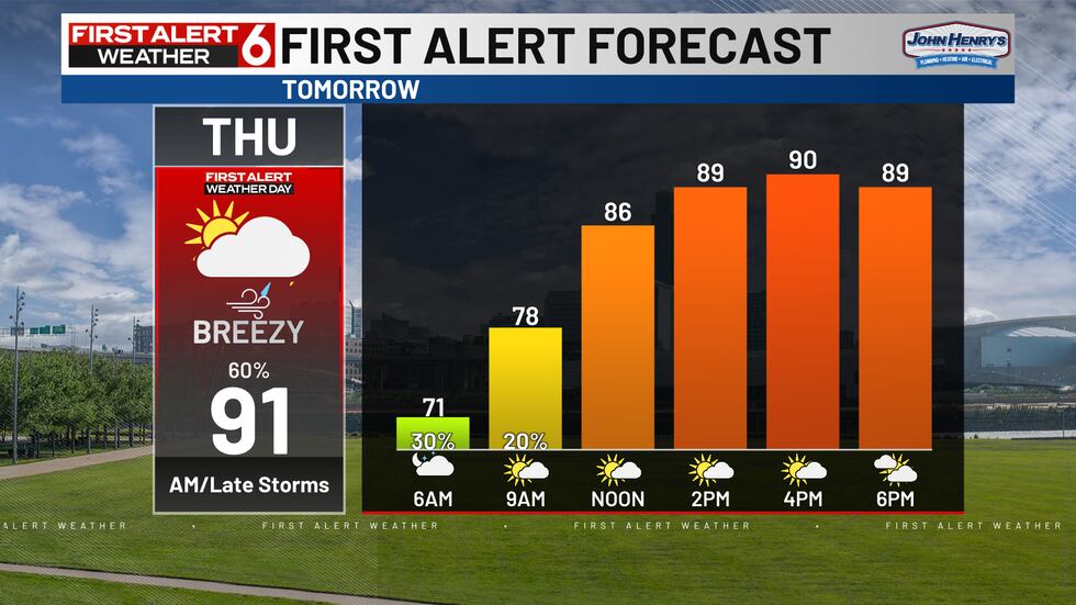
OMAHA, Neb. (WOWT) – Thursday is a First Alert 6 Weather Day with storm potential in both the overnight to morning hours and late evening.
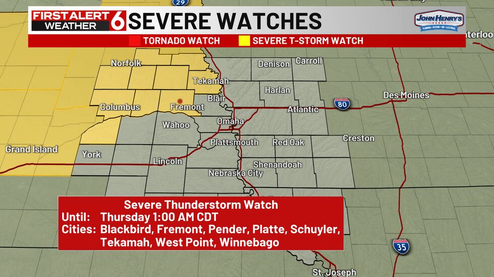
A Severe Thunderstorm Watch has been expanded to include a few more counties NW of the Metro until 1AM. Our line of overnight storms may lose some energy and severe potential as it approaches the Metro around 2-3AM… We’ll keep an eye on mainly a strong wind risk overnight.
After 12AM storm chances increase and continue overnight. The main severe risk with this overnight to early morning round is strong wind gusts of 60+mph.
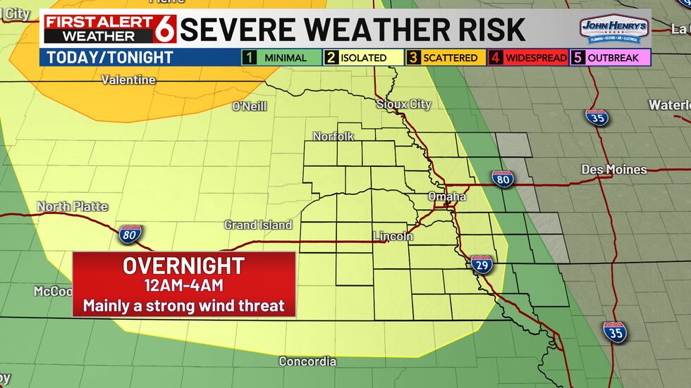
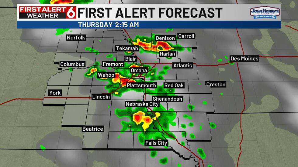
These clear up around the morning commute although the main severe risk ends earlier around 4AM.
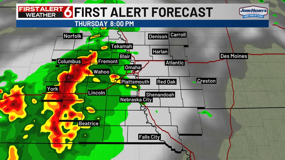
Spotty afternoon t-showers are possible but the chances remain uncertain… if these develop they may influence our storm potential for the evening. It’ll be a hot and humid day with highs in the 90s and a heat index near 100.
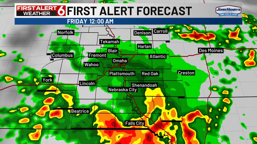
The evening round will likely develop to the west in this yellow shaded severe risk area and gradually move east deeper into the evening and overnight. Best chances arrive in the viewing area after 7PM.
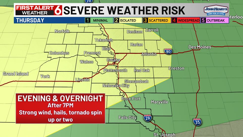
After 10PM storm chances continue overnight but may shift S of I-80.
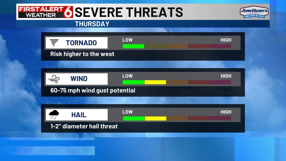
The greatest risk area for tornadoes has shifted to the west as well and lessened quite a bit for us. Hail and wind potential along with some heavy rain will still be of concern though.
Stay up-to-date with the First Alert 6 Weather Team as more details become available.
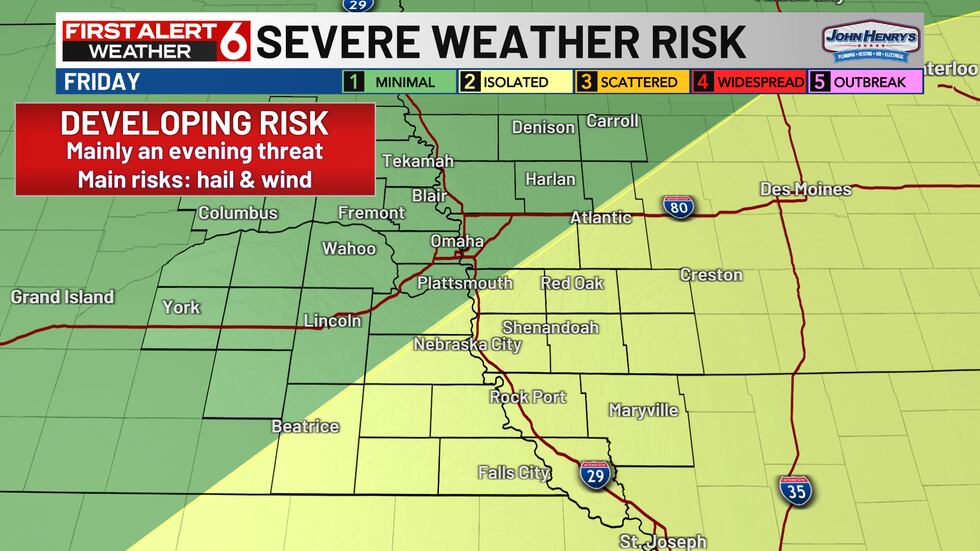
Storms clear up early Friday morning and we’ll be in for another active evening! We are monitoring a developing severe risk for Friday evening that may bring another wind and hail risk. The weekend brings a break from the stormy pattern.

Copyright 2025 WOWT. All rights reserved.