
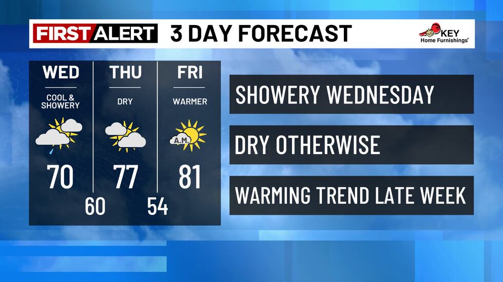
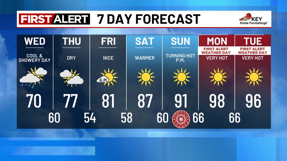
- Cool and showery Wednesday, but no heavy rain
- Comfortable end of week and weekend
- First Alert Weather Days Monday and Tuesday for heat
Download our FOX 12 Weather App so you can be the first to know about changes in the forecast, check radar and watch additional content from our team!
TONIGHT + WEDNESDAY
It was warmer today since we avoided the morning low clouds; we topped out around 80° this afternoon.
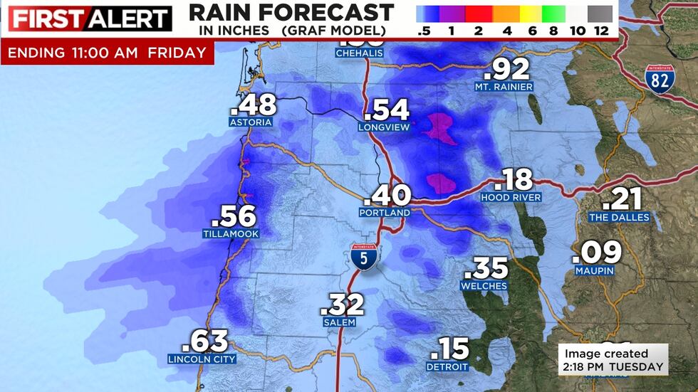
A weak cold front moves inland overnight, with leftover showers continuing through the day. We expect around 1/4” of rain out of this system, not enough to help our gardens much, but enough to remind you that rain is never too far away in Portland. About half of that will fall before sunrise. The morning commute will be drippy with many wet roads, but no heavy rain or thunderstorms.
TIMING: Most of the rain will fall around sunrise or even before, but showers are possible anytime through the rest of the day.or and at most ½” on the northern Oregon and southern Washington coastline.
This will settle the dust a bit but doesn’t help your lawn much…keep watering!
LATER THIS WEEK
We stay cool Thursday with highs in the mid to upper-70s. Morning clouds will gradually clear to sunshine throughout the day, and we’re expecting to stay dry.
Friday will be slightly warmer with highs in the low 80s and a few morning clouds.
HOT TEMPS RETURN + FIRST ALERT WEATHER DAY
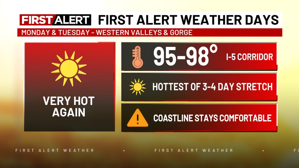
Strong and hot high pressure takes over again starting this weekend and into early next week. The result is another stretch of several days in the 90s. We don’t see this as the beginning of a major heatwave, most likely temperatures fall once again by the middle of next week. We’ll be in the 95+ range again next Monday & Tuesday, so we’ll call those First Alert Weather Days.
🔥 FIRE WEATHER
Looking very good right now! Only two large fires burning in Oregon with minimal spread. The showers/cool weather will keep things under control through this first week of August.
Copyright 2025 KPTV-KPDX. All rights reserved.