
Ahhh, cooling ocean breezes poured inland this evening and temperatures have dropped rapidly. Already down around 70° at 9pm. The Pacific Ocean air-conditioning is set on HIGH right now.
The heat wave didn’t disappoint, we topped out at 99° for three consecutive days in Portland.

That is a rare feat of course, although one viewer noticed that we had FIVE consecutive 49° days back in February 2004. Today was more reasonable, although still up around 90° south of the metro area. Tomorrow will be another 4-8 degrees cooler.
WHAT’S AHEAD
- Cooler Thursday, just a slight chance of morning drizzle out of low cloud cover.
- Very light rain at times Friday…DRIPPY is probably a good word for that day. Cloudy and humid all day
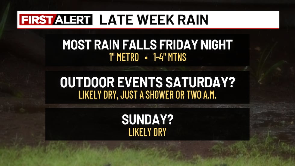
- Expect a soaking for MOST areas from the Cascades westward Friday evening through about sunrise Saturday
- The rest of Saturday and Sunday should be mainly dry with temperatures between 75-80° each afternoon
A rare summertime Atmospheric River will impact the region Friday through very early Saturday. That’s due to an upper-level low offshore and deep southwesterly flow just ahead of it. Here’s Friday afternoon up around 30,000-feet or so.

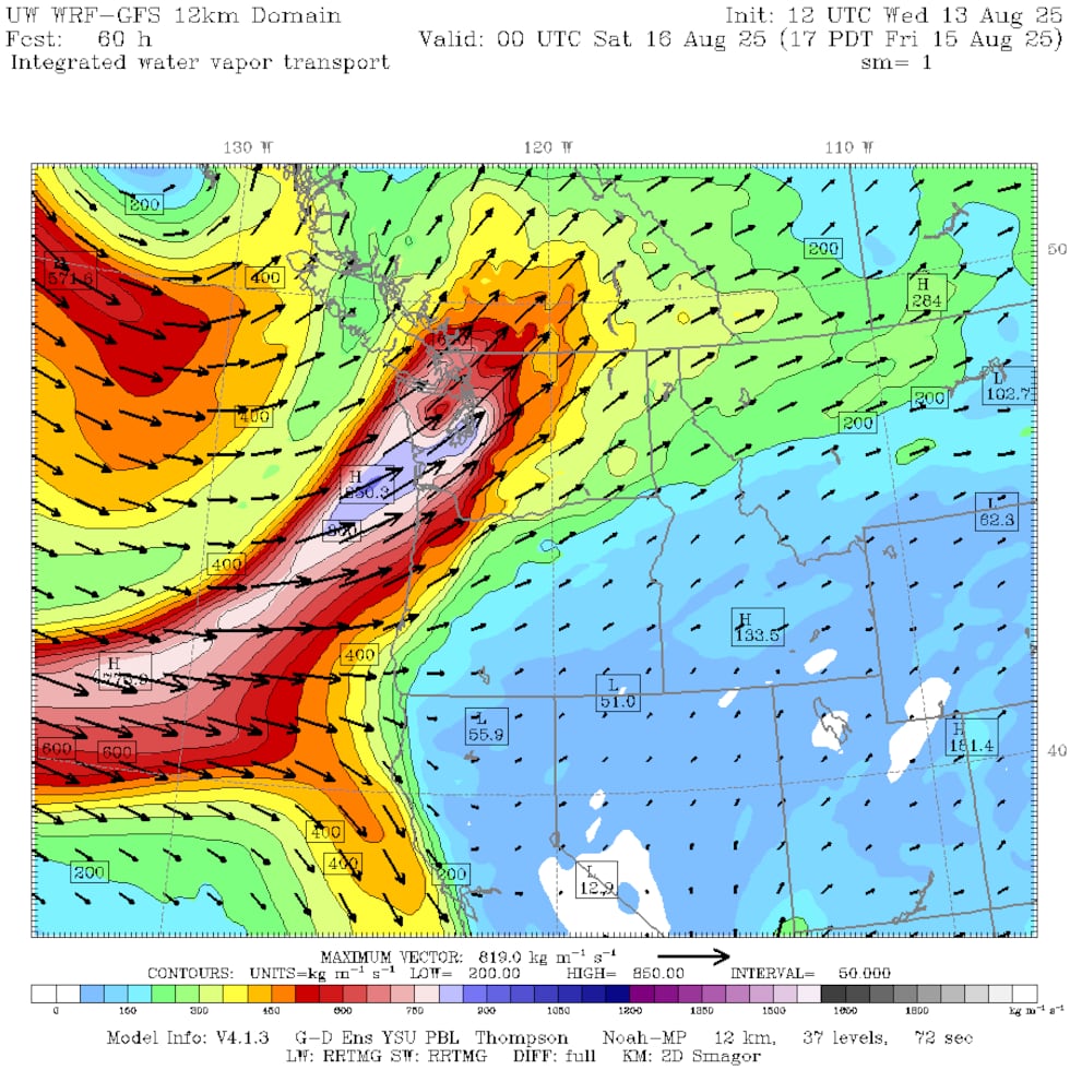
Check out the Integrated Water Vapor Transport (IVT) for that same time. A warm summer airmass can bring a lot of moisture overhead. It’s aimed at western Washington that this point.
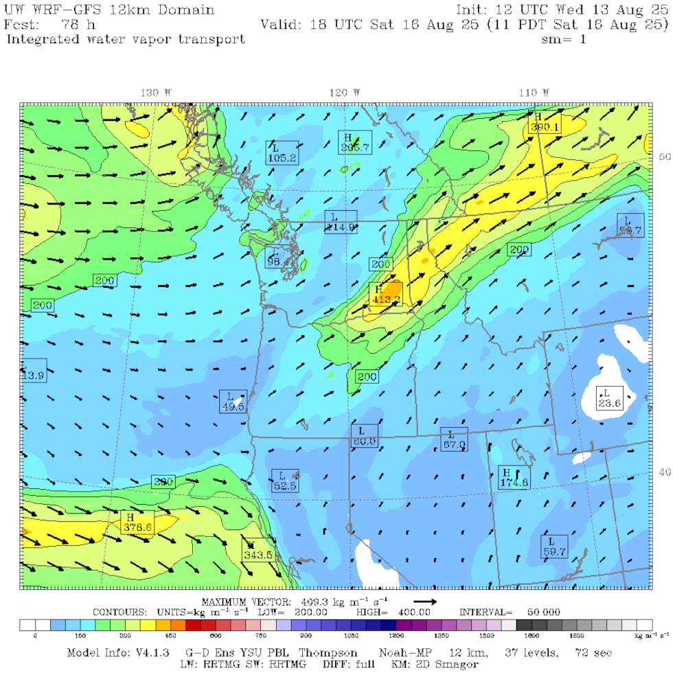
But this atmospheric river isn’t lingering in the region for long. Just 18 hours later it’s gone; the leftovers are falling apart over northeast Oregon.
So yes, it COULD rain a lot more, but this system is moving quickly. Since the flow is coming in from the west-southwest, the mountains will extract far more rain from the clouds than down here in the valleys. The evening GRAF model shows that well.
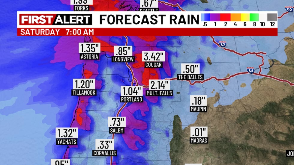
The driest parts of the lowlands (west metro, western Willamette Valley) may get less than 1/2″ rain. That’s because they will be “rain-shadowed” a bit by the Coast Range. But those west slopes of the Cascades and Coast Range will get quite a soaking. 2-4″ is likely; a rare late-summer soaking in the forests. This is a situation where Forest Grove might only pick up 0.25″, but Gresham picks up 1.25″. It’ll get wetter traveling west to east across the metro area. This isn’t a thunderstorm pattern by the way, just a steady and moderate overnight rainfall Friday into Saturday.
The lack of rain in Saturday and Sunday’s forecast? Due to the upper-level low staying well offshore and no significant disturbances rotate through western Oregon/Washington. BUT, a weak system will travel northward across the east side of Oregon Sunday. That could set off some strong thunderstorms…something to keep an eye on.
SUMMARY
So we get a nice soaking Friday night, putting fire season on hold during what is typically the worst time for fires. Then we get a (mainly or all) dry weekend. Your outdoor BBQs, weddings, reunions, and other events should continue uninterrupted by weather.
Copyright 2025 KPTV-KPDX. All rights reserved.