
Weather Headlines
- NEXT 9 HOURS: Muggy scattered storms, possibly strong to severe
- SHORT TERM: Hot and Humid Weekend
- LONG TERM: Comfort isn’t too far away
Latest Forecast
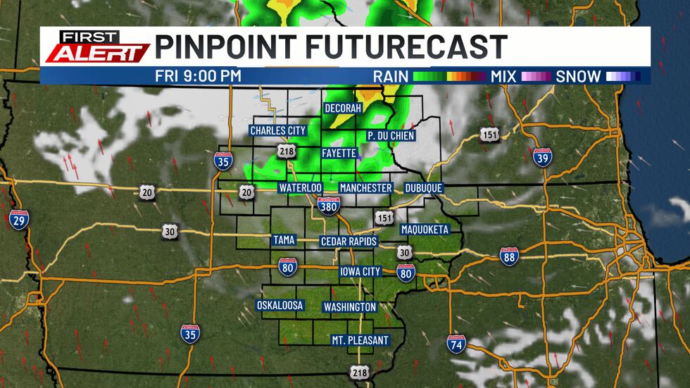
CEDAR RAPIDS, Iowa (KCRG) – Severe weather threat is possible this afternoon. Although isolated in nature, damaging winds and hail could develop across parts of Iowa.

(KCRG)
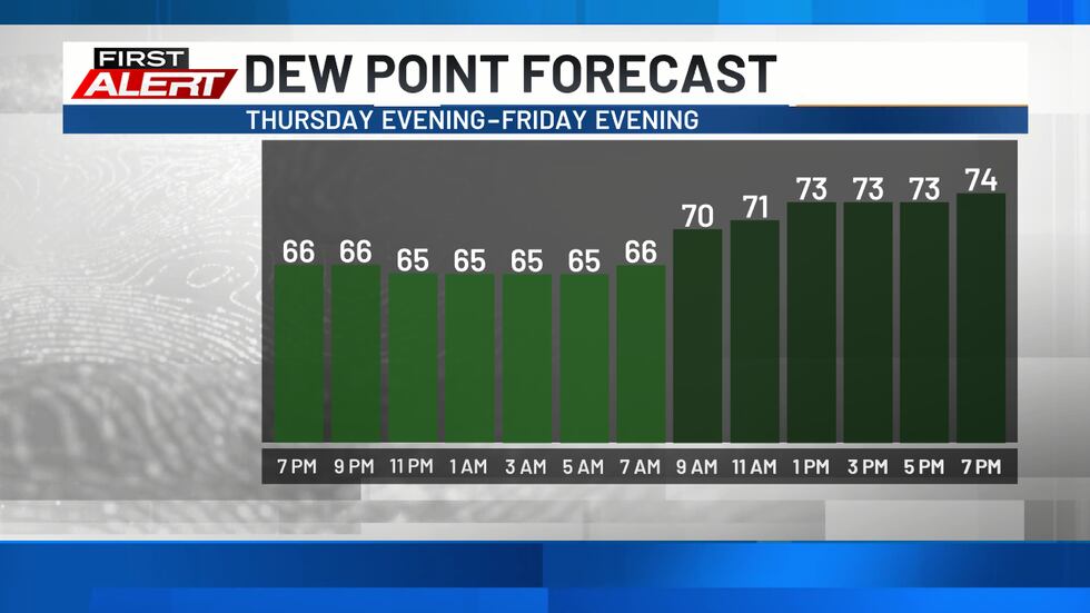
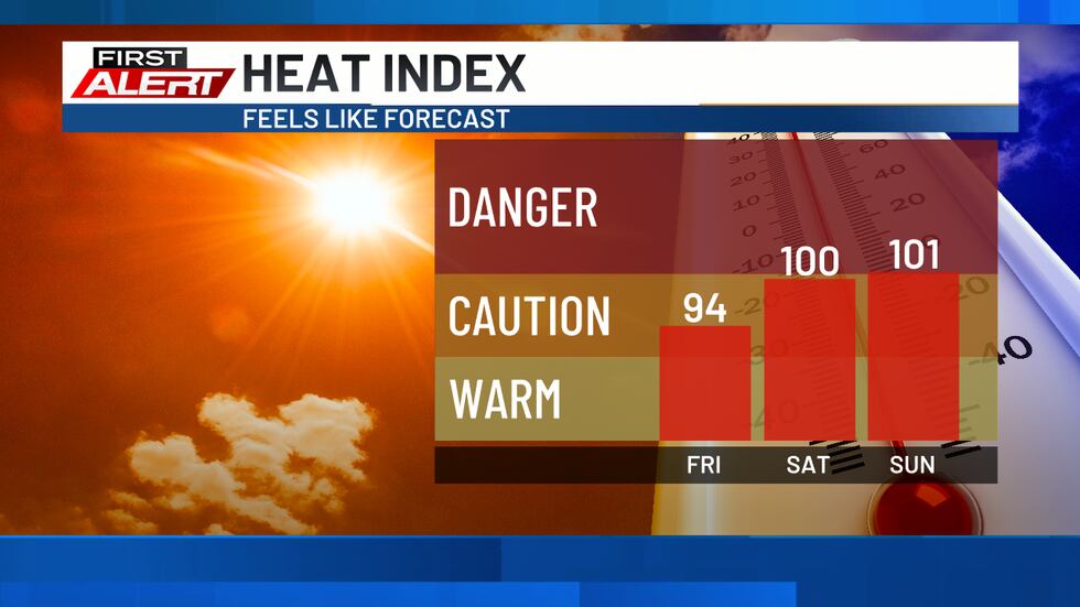
Southern winds for the next few days will continually add heat and humidity to our forecast. Dew points will climb into the 70s, promoting a very muggy feel to the air by the afternoon and evening.
This comes along with warmer air, too, with highs set to reach the mid to upper 80s. Some spots in the south could touch or exceed 90. Combining the two, this would mean heat index readings at least in the mid to upper 90s. It’s just the start of a multi-day period of hotter and more humid weather that lasts into the weekend.
One thing that could save us over the next 24 to 48 hours is the incursion of any storm activity from the more active storm track that will be located to our north. Once in a while, in these types of weather patterns, a cluster of storms dives into the hotter air mass.
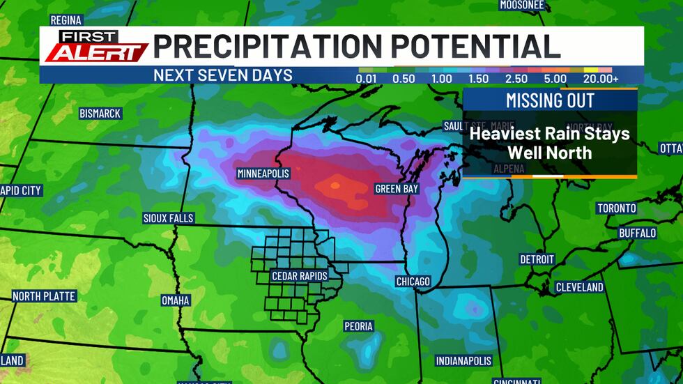
With the more active storm track set to stay to our north, that’s where the heaviest rainfall potential will be. With repeated rounds of storms, several inches of rainfall are possible there. In eastern Iowa, we’ll see lighter totals over the next 7 days.
Copyright 2025 KCRG. All rights reserved.